Search Results for: Satellite

SERTIT: satellite imagery for the environment and crisis management

SERTIT

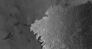
I’MTech is dedicating a series of stories to success stories from research partnerships supported by the Carnot Télécom & Société Numérique Institute (TSN), to which Télécom Physique Strasbourg and IMT belong. The regional image processing and remote sensing service (SERTIT) has specialized in producing geographic information production for over 30 years. It is linked with the ICube[1] laboratory, a key …

Read More »

VIGISAT: monitoring and protection of the environment by satellite

vigisat, surveillance, environnement

Following on from our series on the platforms provided by the Télécom & Société numérique Carnot institute, we will now look at VIGISAT, based near Brest. This collaborative hub is also a project focusing on the satellite monitoring of oceans and continents in high resolution.   On 12th July, scientists in Wales observed a drifting iceberg four times the size of …

Read More »

What is beamforming?

Antenne 5G

Beamforming is a telecommunications technology that enables the targeted delivery of larger and faster signals. The development of 5G relies in particular on beamforming. Florian Kaltenberger, researcher at EURECOM and 5G specialist, explains how this technology works. What is beamforming? Florian Kaltenberger: Beamforming consists of transmitting synchronized waves in the form of beams, from an antenna. This makes it possible to target …

Read More »

Hacked in mid-flight: detecting attacks on UAVs

Hack drone attaque UAVs

A UAV (or drone) in flight can fall victim to different types of attacks. At Télécom SudParis, Alexandre Vervisch-Picois is working on a method for detecting attacks that spoof drones concerning their position. This research could be used for both military and civilian applications. He set out to deliver your package one morning, but it never arrived. Don’t worry, nothing …

Read More »

Smarter models of the ocean

Photographie de l'océan

The ocean is a system that is difficult to observe, whose biodiversity and physical phenomena we still know very little about. Artificial intelligence could be an asset in understanding this environment better. Ronan Fablet, a researcher at IMT Atlantique, presents the projects of the new Océanix Research Chair. What is the objective? To use AI to optimize models for observing the ocean.   …

Read More »

Tracking mobile industrial equipment in real time with Hiboo

Hiboo

The Hiboo start-up was incubated at Télécom Paris and provides a platform to help companies better manage their mobile assets: equipment, merchandise, vehicles etc. This solution is now widely used in the construction industry.   In 2016, the start-up Hiboo, which was incubated at Télécom Paris at the time, created a connected device in order to bring this type of …

Read More »

iXblue: Extreme Fiber Optics

ixblue

Since 2006, iXblue, a French company based in Lannion, and the Hubert Curien laboratory [1] in Saint-Étienne have partnered to develop cutting-edge fiber optics. This long partnership has established iXblue as a global reference in the use of fiber optics in harsh environments. The scientific and technological advances have enabled the company to offer solutions for the nuclear, space and …

Read More »

Data sharing: an important issue for the agricultural sector

partage de données, data sharing

Agriculture is among the sectors most affected by digital transition, given the amount of data it possesses. But for the industry to benefit from its full potential, it must be able to find a sound business model for sharing this data. Anne-Sophie Taillandier, the Director of TeraLab — IMT’s big data and AI platform — outlines the digital challenges facing …

Read More »

Marine oil pollution detected from space

oil pollution

Whether it is due to oil spills or cleaning out of tanks at sea, radar satellites can detect any oil slick on the ocean’s surface. Over 15 years ago, René Garello and his team from IMT Atlantique worked on the first proof of concept for this idea to monitor oil pollution from space. Today, they are continuing to work on …

Read More »

How can AI help better forecast high and low water levels?

flood water level

Predicting the level of water in rivers or streams can prove to be invaluable in areas with a high risk of flooding or droughts. While traditional models are based primarily on hypotheses about processes, another approach is emerging: artificial neural networks. Anne Johannet, an environmental engineering researcher at IMT Mines Alès, uses this approach. This article is part of our …

Read More »