Search Results for: Remote sensing

Remote sensing explained: from agriculture to major disasters

télédétection, remote sensing

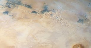
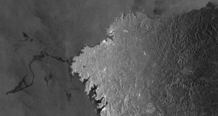
There are numerous applications for remote sensing, from precision agriculture to helping with the deployment of aid in major disasters. Grégoire Mercier, a researcher at IMT Atlantique, explains the key notions of this remote observation method using examples from his research.   Detecting invisible objects from space… this is now possible through remote sensing. This remote observation method is currently …

Read More »

Ocean remote sensing: solving the puzzle of missing data

Ocean Remote sensing, data, IMT Atlantique

The satellite measurements that are taken every day rely greatly on atmospheric conditions, the main cause of missing data. In a scientific publication, Ronan Fablet, a researcher at Télécom Bretagne, proposes a new method for reconstructing the temperature of the ocean surface to complete incomplete observations. This reconstructed data provides fine-scale mapping of the homogeneous details that are essential in …

Read More »

SERTIT: satellite imagery for the environment and crisis management

SERTIT

I’MTech is dedicating a series of stories to success stories from research partnerships supported by the Carnot Télécom & Société Numérique Institute (TSN), to which Télécom Physique Strasbourg and IMT belong. The regional image processing and remote sensing service (SERTIT) has specialized in producing geographic information production for over 30 years. It is linked with the ICube[1] laboratory, a key …

Read More »

Pierre Comon: from the brain to space, searching for a single solution

Pierre Comon

Pierre Comon’s research focuses on a subject that is as simple as it is complex: how to find a single solution to a problem. From environment to health and telecommunications, this researcher in information science at GIPSA-Lab is taking on a wide range of issues. Winner of the IMT-Académie des Sciences 2018 Grand Prix, he juggles mathematical abstraction and the …

Read More »

Environmental data: data science takes on the challenge

data science, pierre tandeo

From July 3 to July 7, a series of conferences was held on data science and the environment. The event, organized by IMT Atlantique, builds bridges between two communities between whom there has been little collaboration in Europe so far. Environmental data could benefit from new processing methods that could help to explain what, until now, has been impossible for …

Read More »

An ocean of environmental data to be processed

René Garello, Vigisat, Océan, Télécom Bretagne, Ocean

If nowadays we can detect icebergs along the route of the Vendée Globe, track and identify ships causing pollution from space, and define ecological corridors and reserves for the protection of animal species, it is largely thanks to stations which receive and process satellite images in real time, and the progress made in the last twenty years in the field …

Read More »

Marine oil pollution detected from space

oil pollution

Whether it is due to oil spills or cleaning out of tanks at sea, radar satellites can detect any oil slick on the ocean’s surface. Over 15 years ago, René Garello and his team from IMT Atlantique worked on the first proof of concept for this idea to monitor oil pollution from space. Today, they are continuing to work on …

Read More »